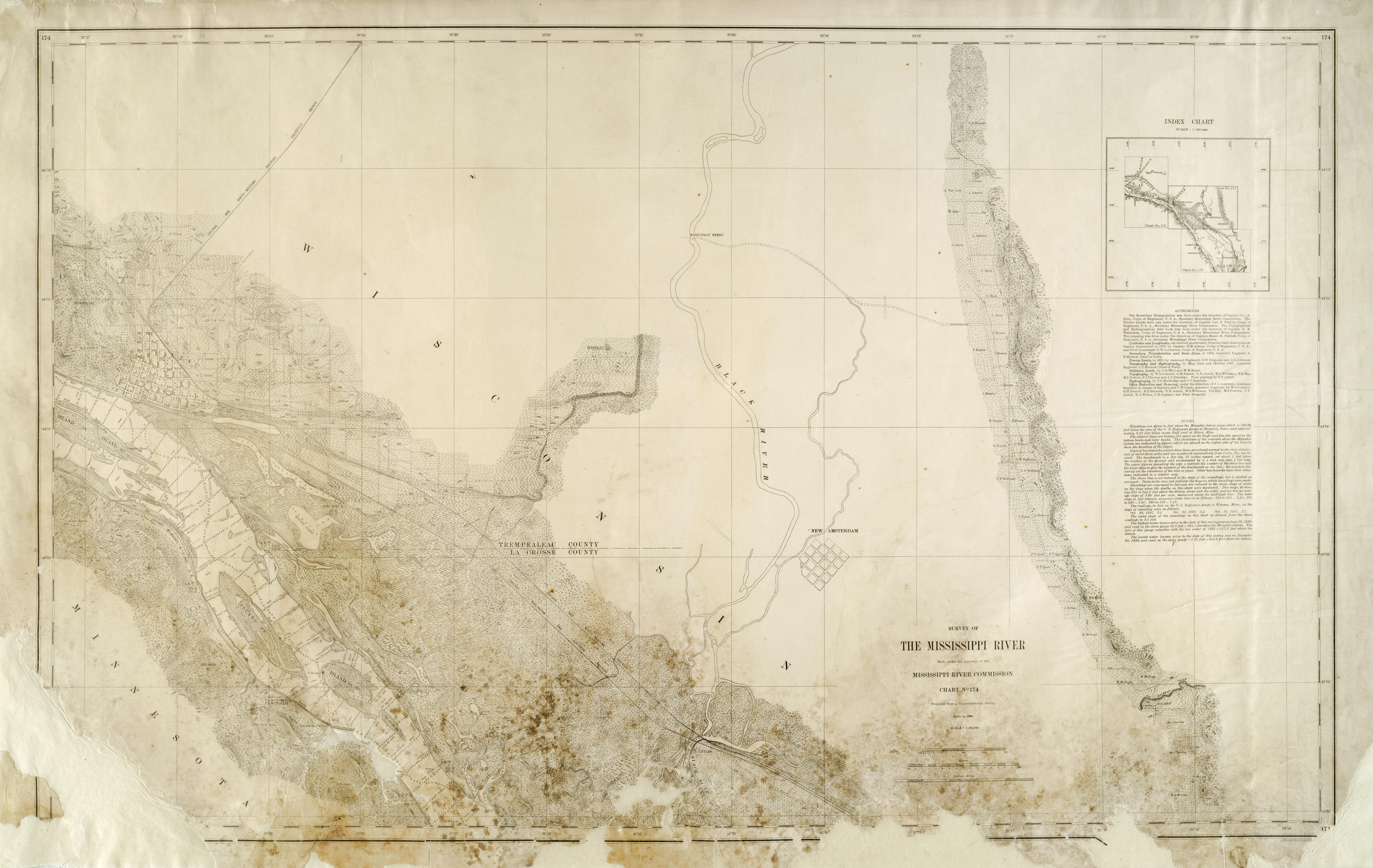
Projected from a trigonometrical survey made in 1894
Relief shown by hachures, spot heights, and contours
Depths shown by soundings
Army Corps of Engineers assisted with map creation
Includes a list of "Authorities," "Note," and "Index chart"
Shows street names, railroads, dikes, United States lights, diamond boards, bridges, river depths, vegetation types, gravel pit, Holmen, Wisconsin, Holmen [Bluff], New Amsterdam, Wisconsin, Trempealeau, Wisconsin, Black River, Richmond Station, Lytles, Trempealeau [Bluff], Round Lake, Long Lake, East Base [Bluff], Richmond [Bluff], Kings Bluff, Queens Bluff, West Base [Bluff], Hammond Chute, Beardsley [Bluff], McGilvray ferry, Halfway Creek
