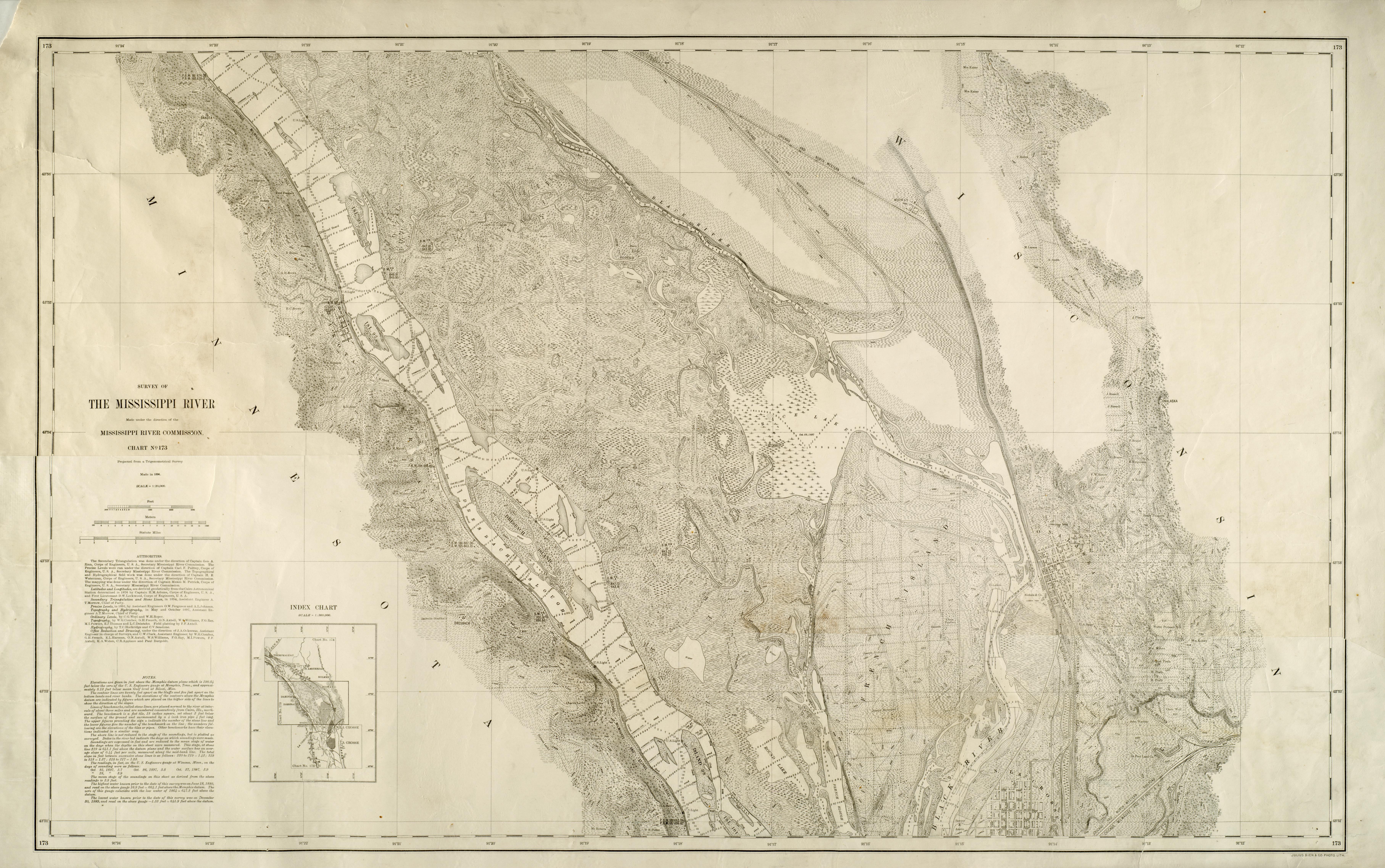
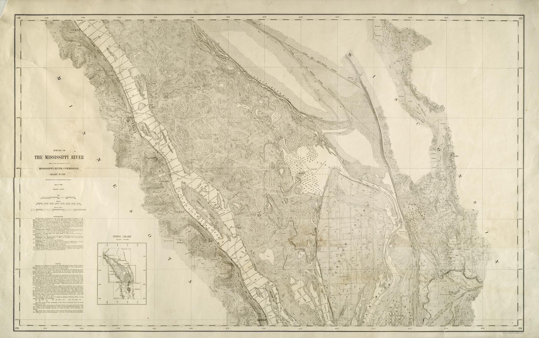
Projected from a trigonometrical survey made in 1894
Relief shown by hachures, spot heights, and contours
Depths shown by soundings
Army Corps of Engineers assisted with map creation
Includes a list of "Authorities," "Note," and "Index chart"
Shows railroads, dikes, United States lights, bridges, river depths, diamond boards, vegetation types, street names, lumber yards, sawmills, Onalaska, Wis. Midway, Dresbach, Minn, Dakota, Minn., North La Crosse, Black River, French Island, Rice Lake, Dresbach Island, Riverside Farm, Dresbach Slough, Gun Slough, Rice Lake, Round Lake, French Slough, La Crosse River, Onalaska [Bluff], Dakota [Bluff], Dresbach [Bluff].
