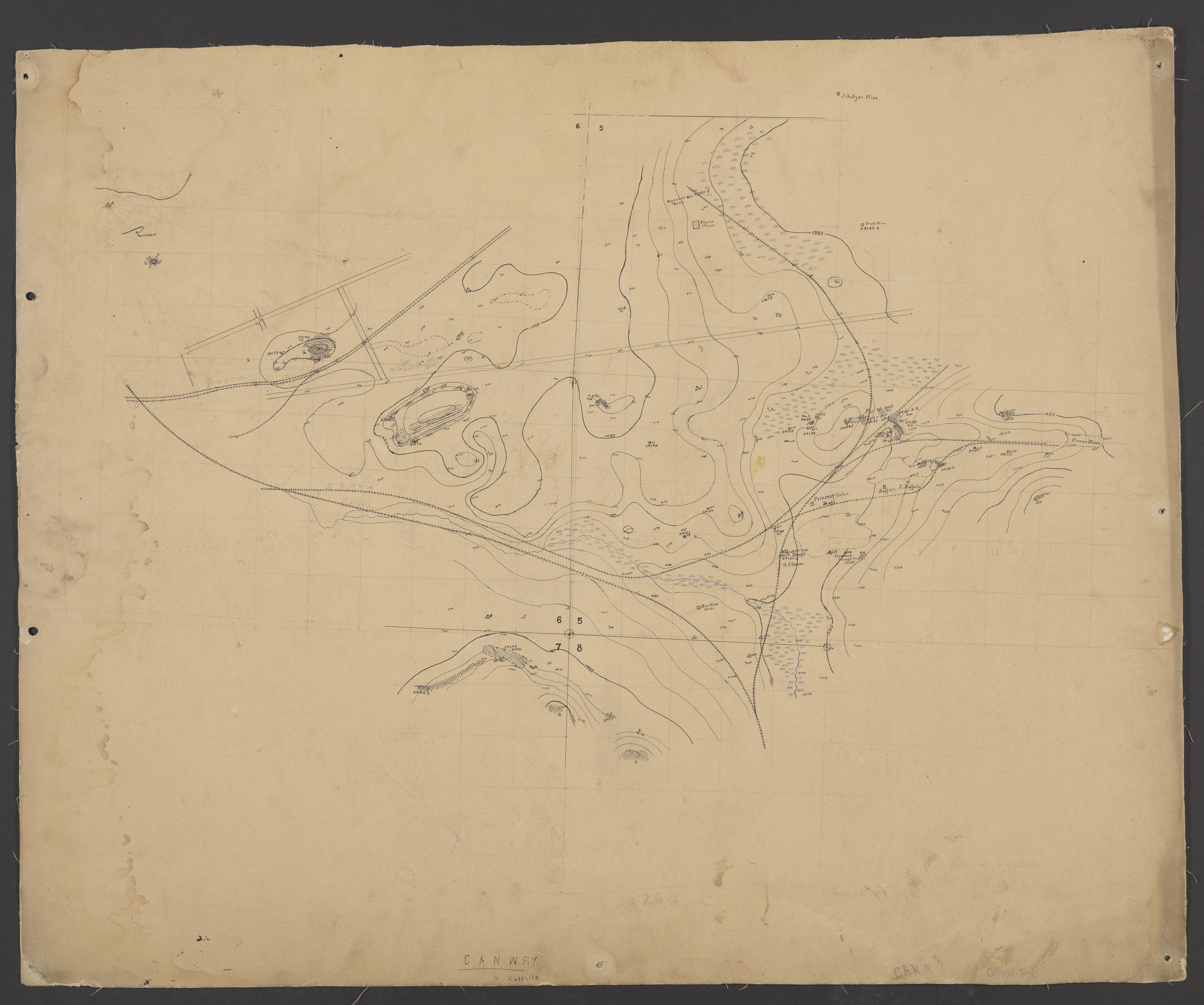
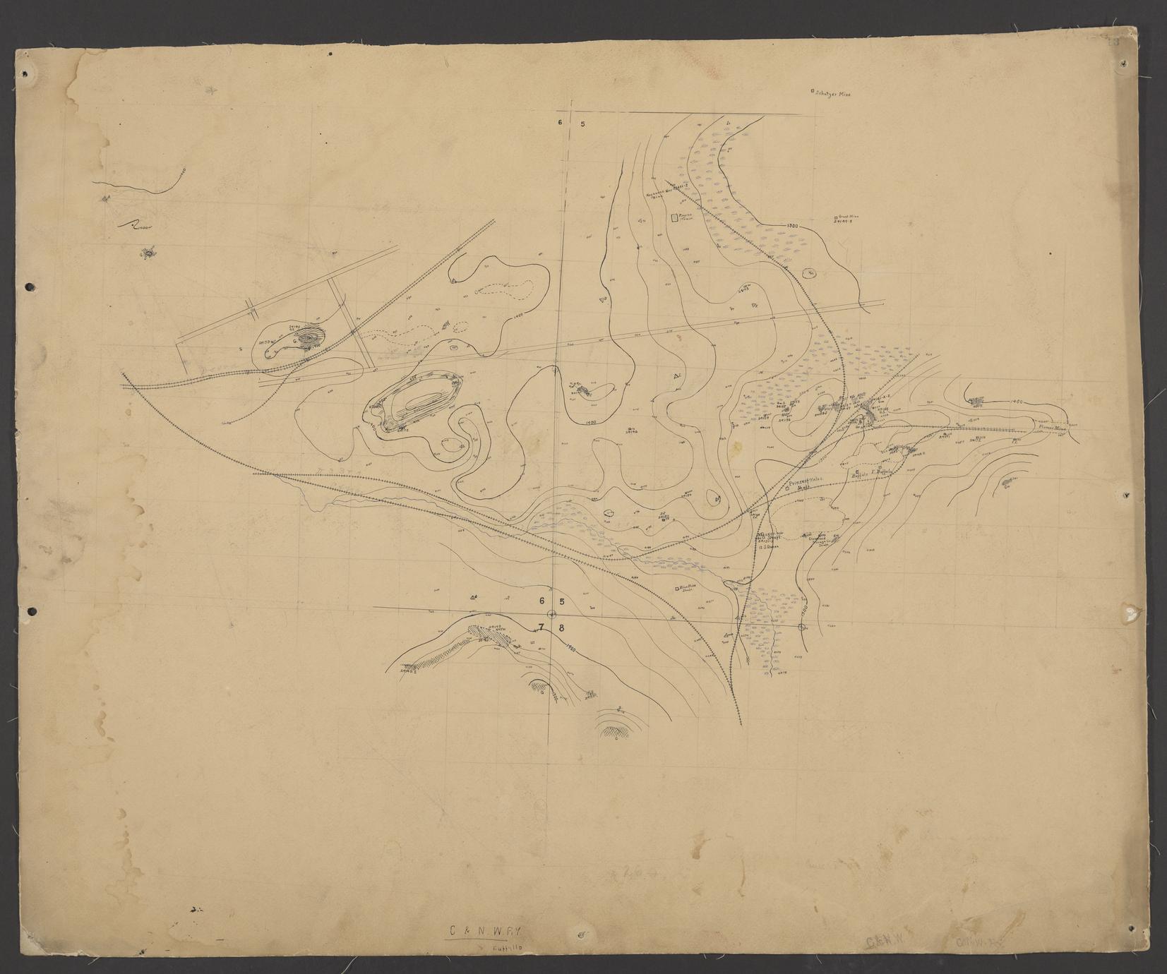
Contour map of Negaunee area (Marquette County, Michigan)
Date
ca. 1893
Summary
Hand drawn contour map of Township 47 North, Range 26 West, parts of Sections 5, 6, 7, and 8. Includes locations where geological samples were taken, and plane table mapping points. Accompanies descriptions in notebook number 154. Other features include some street plans, railroad tracks, and mine locations.
