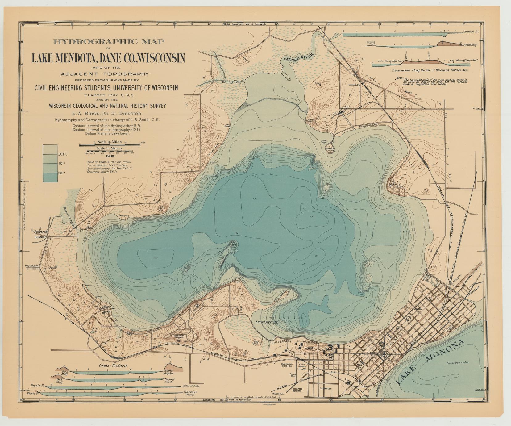
Hydrographic map of Lake Mendota. Prepared from surveys made by civil engineering students, University of Wisconsin, classes 1897, 1898, 1899, 1900 and by the Wisconsin Geological and Natural History Survey. Scale: 1 inch = 1/3 mile. Contour interval = 10 feet (topography). Contour interval = 5 feet (hydrography)