Website Search
Find information on spaces, staff, and services.
Find information on spaces, staff, and services.
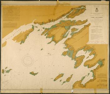
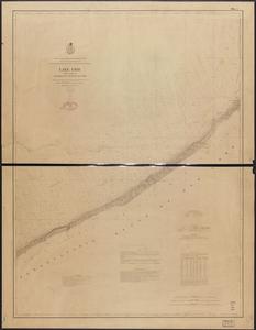
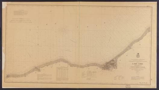
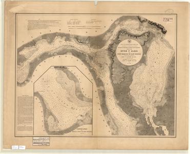
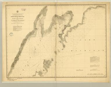
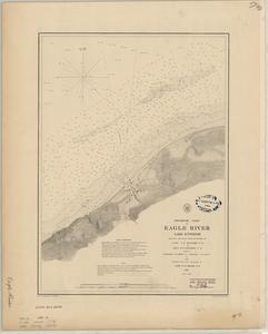
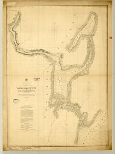
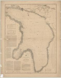
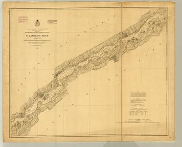
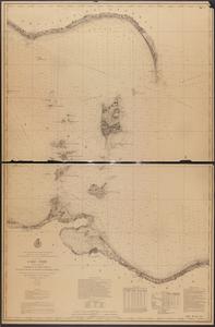
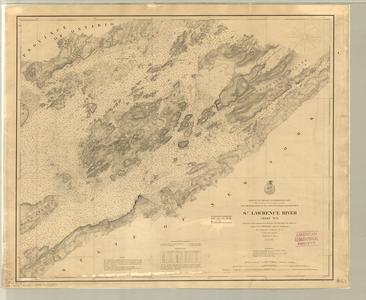
Lake Survey maps that document waterborne transportation on the Great Lakes in the late nineteenth century. These highly accurate nautical charts reveal the inherent dangers posed by rocky shorelines and narrow passages. For more information about these images or waterborne transportation on the Great Lakes, contact Wisconsin's Water Library or the University of Wisconsin Sea Grant Institute.
![Preliminary chart of Tawas Harbor [Harbor of Refuge, Lake Huron]](https://asset.library.wisc.edu/1711.dl/BWV3JOTB2VWWO83/M/h300-17630.jpg)


This compilation (including design, introductory text, organization, and descriptive material) is copyrighted by University of Wisconsin System Board of Regents.
This copyright is independent of any copyright on specific items within the collection. Because the University of Wisconsin Libraries generally do not own the rights to materials in these collections, please consult copyright or ownership information provided with individual items.
Images, text, or other content downloaded from the collection may be freely used for non-profit educational and research purposes, or any other use falling within the purview of "Fair Use".
In all other cases, please consult the terms provided with the item, or contact the Libraries.
Copied!