Website Search
Find information on spaces, staff, and services.
Find information on spaces, staff, and services.
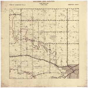
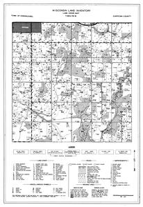
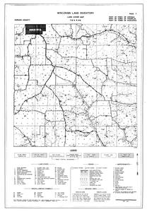
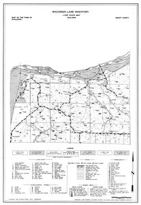
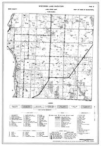
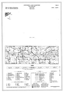
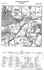
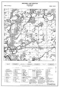
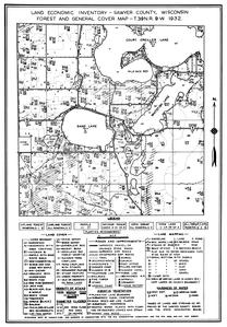
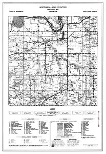
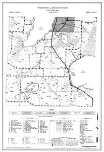
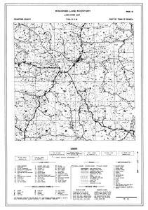
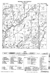
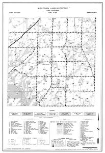
Often called the "Bordner Survey" after its director, John Bordner, the Wisconsin Land Economic Inventory was a Depression-era project to inventory the land resources of Wisconsin so that they could be used more productively. Field workers, usually trained foresters, tried to touch each "forty" in a county and map current land use and land cover, signs of erosion, and size and quality of stands of timber. Included on the maps are such features as houses, schools, churches, taverns, cheese factories, filling stations, and logging camps. Each map covers one survey township. Milwaukee County was not mapped, and maps for Lincoln, Manitowoc, and Sheboygan counties were not published. Land in Menominee County, established in 1961, is included as part of Langlade, Oconto, and Shawano Counties. Together, these maps present a portrait of the Wisconsin landscape during the 1930s and 1940s.
For more information, see Wisconsin Land Economic Inventory, Land Cover Maps.

This compilation (including design, introductory text, organization, and descriptive material) is copyrighted by University of Wisconsin System Board of Regents.
This copyright is independent of any copyright on specific items within the collection. Because the University of Wisconsin Libraries generally do not own the rights to materials in these collections, please consult copyright or ownership information provided with individual items.
Images, text, or other content downloaded from the collection may be freely used for non-profit educational and research purposes, or any other use falling within the purview of "Fair Use".
In all other cases, please consult the terms provided with the item, or contact the Libraries.
Copied!